
Kampala to Bwindi Road Trip Guide
Kampala to Bwindi Road Trip Guide, Routes, Distances, Road Conditions, Fuel Stops, and a Complete Self-Drive Itinerary to Uganda’s Mountain Gorilla Country
| QUICK FACTS: KAMPALA → BWINDI
Distance: approximately 460–540 km depending on route and sector (Buhoma, Ruhija, Rushaga, or Nkuringo) Drive time: 8–10 hours, best split over two days with an overnight stopover Recommended vehicle: 4×4 (Toyota RAV4, Land Cruiser, or Toyota Hilux double-cab) Main route: Kampala – Masaka – Mbarara – Kabale – Bwindi (mostly tarmac, with murram in the final stretch) Gorilla permit (2026): USD 800 peak season / USD 600 low season (April, May, November) for foreign non-residents |

A self-drive road trip from Kampala to Bwindi Impenetrable National Park ranks among East Africa’s most rewarding overland journeys. The route threads through the rolling hills of Masaka, the cattle country around Mbarara, the terraced slopes of the Kigezi Highlands, and finally into the misty forests that shelter roughly half the world’s remaining mountain gorillas. This guide breaks down every route option, the actual road conditions you will encounter in 2026, realistic drive times, fuel and rest stops, vehicle recommendations, and a sample multi-day itinerary so you can plan a safe, well-paced trip from the capital to gorilla country.
Distance From Kampala To Bwindi: What The Numbers Actually Mean
Ask five tour operators the distance from Kampala to Bwindi and you will likely get five different numbers, ranging anywhere from 440 km to 550 km. This is not inconsistency for its own sake — the figure depends entirely on which of Bwindi’s four trekking sectors you are heading to (Buhoma, Ruhija, Rushaga, or Nkuringo) and which highway corridor you take to get there. As a rule of thumb, budget 460–540 km and 8–10 hours of actual driving time, excluding stops.
| Destination Sector | Approx. Distance | Approx. Drive Time | Road Surface |
| Buhoma (via Kabale – Kanungu) | 440–460 km | 7–9 hours | Tarmac to Rukungiri, then murram |
| Ruhija (via Kabale) | 460–480 km | 8–9 hours | Tarmac to Kabale, murram mountain road |
| Rushaga (via Kabale – Kisoro) | 520–540 km | 9–10 hours | Tarmac to Kisoro, murram to sector |
| Nkuringo (via Kabale – Kisoro) | 510–530 km | 9–10 hours | Tarmac to Kisoro, steep murram climb |
Route 1: The Main Highway Corridor (Kampala – Masaka – Mbarara – Kabale)
This is the route almost every self-drive traveler and tour operator uses, and for good reason. It follows Uganda’s best-maintained tarmac highway southwest out of Kampala through Masaka and Mbarara before climbing into the Kigezi Highlands at Kabale. From Kabale, you branch off onto a murram (gravel) feeder road for the final 90–120 km to whichever Bwindi sector you are trekking in.

- Kampala to Masaka: roughly 2.5 hours on a well-maintained dual carriageway for much of the stretch.
- Masaka to Mbarara: about 2 hours, passing the Uganda Equator crossing near Kayabwe just south of Masaka.
- Mbarara to Kabale: roughly 2–2.5 hours, climbing steadily into cooler highland terrain.
- Kabale to Bwindi: 1.5–4 hours depending on sector, mostly on murram roads with switchbacks.
Route 2: Via Ishasha and Queen Elizabeth National Park
Travelers combining Bwindi with a Queen Elizabeth National Park game drive often route through Ishasha, approaching Bwindi’s Buhoma sector from the north rather than via Kabale. This adds wildlife viewing (including Ishasha’s tree-climbing lions) to the itinerary but extends total driving time and requires a 4×4 for the Ishasha – Buhoma stretch, which is unpaved and can be slow in wet weather.
Route 3: Kabale – Kisoro – Rushaga/Nkuringo (Southern Sectors)
If your gorilla permit is booked for the Rushaga or Nkuringo sectors in the south of Bwindi, the route continues past Kabale to Kisoro before turning north into the park. This is the longest option from Kampala but rewards drivers with dramatic views of the Virunga volcanoes and Lake Mutanda along the way.
| ROAD CONDITION NOTE FOR 2026
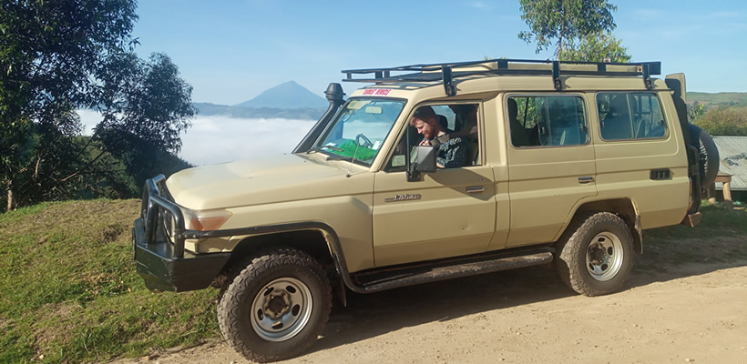
The Kampala – Mbarara – Kabale highway remains largely tarmacked and in good condition, though sections near Masaka and Mbarara occasionally undergo maintenance that can cause short delays. The final approach into all four Bwindi sectors is unpaved, steep, and narrow in places. A 4×4 with good ground clearance is strongly recommended, especially during the March–May and September–November rainy seasons. Always confirm current road status with your car rental company or a local operator close to your travel date, as conditions can change seasonally. |
Choosing The Right Vehicle For The Trip
The tarmac sections of this route are comfortable in any well-maintained sedan or crossover, but the murram roads into Bwindi — particularly the Ruhija and Nkuringo approaches — involve steep gradients, loose gravel, and occasional deep ruts after rain. A 4×4 is not just a comfort upgrade here; it is the safer, more reliable choice.
- Toyota RAV4: a popular mid-size 4×4 with enough clearance for murram roads and manageable fuel consumption for a long highway stretch.
- Toyota Land Cruiser Prado or 100/200 Series: the standard choice for tour operators, offering superior ground clearance and stability on steep, wet sections.
- Toyota Hilux Double Cab: a strong choice for travelers also carrying camping gear, with the option of a rooftop tent for overnight stops en route.
- 2WD sedans and hatchbacks: fine for the Kampala–Kabale tarmac stretch, but not recommended for the final approach into Bwindi, especially in the rainy season.
Where To Break The Journey: Recommended Stopovers
Covering 460–540 km and 8–10 hours of driving in a single day is possible but tiring, and it leaves little time to enjoy the scenery. Most experienced self-drive travelers split the trip over two days, breaking the journey around the Mbarara or Lake Mburo area.
| Stopover | Distance From Kampala | Why Stop Here |
| Uganda Equator, Kayabwe | ≈ 72 km | Quick photo stop straddling the equator line, cafes and curio shops |
| Lake Mburo National Park | ≈ 240 km | Popular overnight break; short game drive or boat cruise possible |
| Igongo Cultural Centre, Mbarara | ≈ 290 km | Museum, restaurant, and comfortable lodging just outside Mbarara |
| Kabale Town / Lake Bunyonyi | ≈ 410–420 km | Scenic highland overnight before the final push into Bwindi |
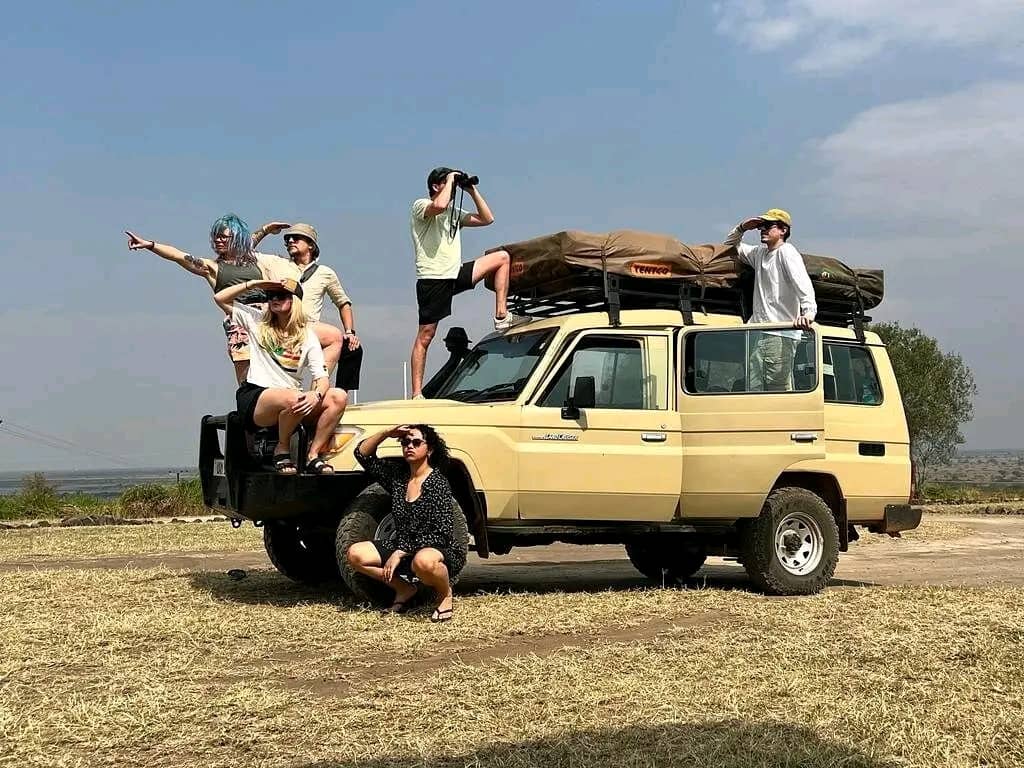
Breaking the journey at Lake Mburo or Kabale is the most common strategy: it shortens each day’s drive to a manageable 4–6 hours, allows time to enjoy the changing scenery of the Kigezi Highlands in daylight, and reduces the risk of arriving at Bwindi’s rougher access roads after dark.
Fuel, Driving Tips, And Practical Advice
Fuel Stops
Fuel stations are frequent and reliable along the tarmac stretch from Kampala through Masaka, Mbarara, and Kabale, including major brands such as Shell, Total, and Stabex. Once you branch off toward Bwindi itself, fuel stations become sparse. Top up fully in Kabale or Kisoro before making the final approach, as there are limited fueling options within the park’s immediate vicinity.
Driving Tips For The Route
- Start early. Aim to leave Kampala by 6:00–7:00 AM to clear the city before rush-hour traffic and to arrive at your destination well before dark.
- Avoid night driving on the murram sections into Bwindi. Visibility is poor, wildlife occasionally crosses the road, and the terrain is unfamiliar even for experienced drivers.
- Watch for speed bumps and pedestrians through trading centers such as Lukaya, Lyantonde, and Ntungamo — speed limits drop sharply and are strictly enforced in these zones.
- Carry a spare tire, jack, and basic toolkit; rental agencies typically supply these, but always confirm before departure.
- Download offline maps (Google Maps offline or Maps.me) for the final stretch, as mobile network coverage becomes patchy near the park.
- Keep both a Uganda shillings cash reserve and a card for fuel and tolls, since rural fuel stations do not always accept cards.
| SAFETY REMINDER
Always check the latest Uganda road safety and travel advisory updates before departure, and register your itinerary with your car rental company or safari operator. Carry a fully charged phone, a printed route map as backup, and emergency contact numbers for your rental company and travel insurer. Health and security conditions in the region can change; confirm current guidance through official government travel advisories close to your travel date. |
Gorilla Trekking Permits: What To Budget For 2026
No Kampala-to-Bwindi road trip is complete without factoring in the gorilla trekking permit, which is the single largest line item on most itineraries and must be booked through a licensed Ugandan tour operator, as the Uganda Wildlife Authority no longer sells permits directly to individual foreign travelers.
| Permit Type | Foreign Non-Resident | Foreign Resident | East African Citizen |
| Standard trekking (peak season) | USD 800 | USD 700 | UGX 300,000 |
| Standard trekking (low season: Apr, May, Nov) | USD 600 | USD 500 | UGX 300,000 |
| Gorilla habituation experience | USD 1,500–1,800* | USD 1,000 | UGX 750,000 |
*Habituation experience pricing is scheduled to rise to USD 1,800 for foreign non-residents from January 2027. Low-season discounted permits are non-reschedulable once booked, so only choose this option if your travel dates are firm.
Sample 2-Day Self-Drive Itinerary: Kampala To Bwindi
Day 1: Kampala – Lake Mburo / Mbarara Area
- 6:00 AM – Depart Kampala, heading southwest on the Masaka Road.
- 8:30 AM – Photo stop at the Uganda Equator, Kayabwe.
- 10:00 AM – Pass through Masaka; refuel and stretch.
- 12:30 PM – Arrive Lake Mburo area or Igongo Cultural Centre for lunch and an overnight stay.
- Afternoon – Optional short game drive or boat cruise at Lake Mburo National Park.
Day 2: Lake Mburo – Kabale – Bwindi
- 7:00 AM – Depart for Mbarara, then continue toward Kabale.
- 10:30 AM – Arrive Kabale; refuel fully and take a break overlooking Lake Bunyonyi.
- 11:30 AM – Begin the final murram approach toward your booked sector (Buhoma, Ruhija, Rushaga, or Nkuringo).
- 1:30–3:30 PM – Arrive at your lodge in Bwindi, with time to rest ahead of the next morning’s gorilla trek.
This two-day pace keeps each driving segment under six hours, builds in a scenic overnight stop, and ensures you reach Bwindi’s rougher access roads in daylight — the single most important safety factor on this route.

Frequently Asked Questions
Is it safe to self-drive from Kampala to Bwindi?
Yes, the route is regularly driven by both tourists and tour operators. The tarmac highway to Kabale is well-traveled and generally safe during daylight hours; the main risks are the unpaved final approach and driving after dark, both of which are avoidable with early starts and a two-day pace.
Can I drive to Bwindi in a normal sedan?
You can reach Kabale comfortably in a 2WD sedan, but the final stretch into any Bwindi sector involves steep, unpaved roads that are best handled by a 4×4, particularly in the rainy season.
How long should I allow for the trip?
Plan for two driving days each way at minimum, or one very long day if you are experienced with East African road conditions and depart before dawn. Most travelers combine the drive with an overnight stop at Lake Mburo or Kabale.
Do I need a 4×4 rental with a driver, or can I self-drive?
Both options are common. Self-driving gives you full flexibility and is popular with confident, experienced overland travelers; hiring a car with a driver-guide is a good choice for first-time visitors unfamiliar with Uganda’s rural roads and murram driving conditions.
Final Thoughts
The road trip from Kampala to Bwindi is as much a part of the safari experience as the gorilla trek itself. Plan for 460–540 km depending on your sector, budget two unhurried driving days, choose a 4×4 for the final approach, and break the journey at Lake Mburo or Kabale to arrive rested and ready for the forest. With the right vehicle, an early start, and a realistic pace, the drive south becomes one of the most memorable stretches of an East African road trip.